 Here you will find maps of the Millers River watershed showing various significant and notable features. Click on a map to see a full page view of it. Special thanks to MassDEP for preparing these maps of:
- the major streams and sub-watersheds and the main stems of the Millers and Otter Rivers
- watershed land use
- open space/conservation lands.
- Millers Elevation Profile
Major streams and shaded sub-watersheds are displayed in the map below. Each color is a distinct tributary area. The Otter River watershed is the yellow shaded area on the lower right side of the map. The main stem of the Millers River is noted in dark blue and the Otter River in light blue.

Map of the Millers River Watershed
Top of Page
The dominant land use in the Millers River basin is forest as illustrated below.
- Green = forest
- Orange = residential
- Red is commercial
- Purple = industrial in Massachusetts

Map of Land Use in the Millers River Watershed
Top of Page
Open space and conservation lands are dispersed throughout the watershed, both in New Hampshire and Massachusetts. Each state lists open space/conservation lands a bit differently. Note the legend for color codes on the types of open space. Although there is considerable conservation land, much land along the river needs protection.

Map of Open Space in the Millers River Watershed
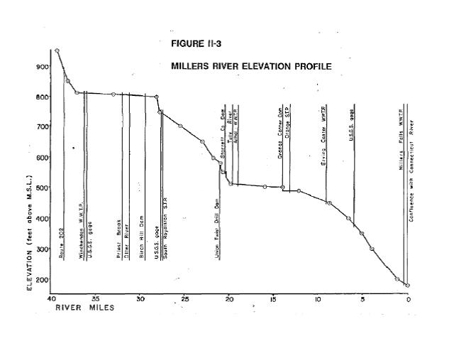
Millers Elevation Profile


