 Native Americans first settled in this area because of the river. Salmon and trout were abundant and the land along the river bank was fertile for planting corn. While the Nipmucs were the dominant Native American Tribe known to have settled in and used this region, it was frequented by many others. According to the Athol History Trail brochure (1976), a “Great Trail” 18 inches wide passed through Athol. “For the Indians of New England, this path formed the main ‘High Road’ (mostly hill country) running from south to north. It began on the ocean shore in Connecticut, and blazed through this inland forest to their great hunting and trade regions of the far north. The Pequoig Indians welcomed these travelers.”
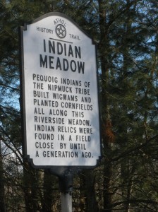
Concerning the “Indian Meadow” along the river in Athol, the Brochure states: “Pequoig Indians of the Nipmuc Tribe built wigwams and planted cornfields all along this riverside meadow. Indian relics were found in a field close by until a generation ago.” The Brochure continues: “Konkeput was their chief. They built their council fires on these plains, gathered the wild grain on these meadows, hunted the deer on these hills. Here they gave their sons and daughters in marriage, and here they buried the bones of their fathers.”
The drama of King Phillip’s War visited the area in 1676, more than 50 years before British colonists were to occupy this region. On February 10th, a large Indian raiding party destroyed the town of Lancaster, after which they marched 45 miles to the west “with all their women, children, aged, and captive.”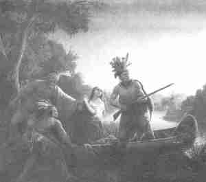 On March 3rd, after reaching the Millers River in present-day Athol and pursued by 400 colonial soldiers, over 2000 Indians and their captives, including Mary Rowlandson, escaped by crossing the river on rafts.
In her diary, Mary Rowlandson stated that the Indians called the river Baquag (Pequoig). First published in 1682 as The Sovereignty and Goodness of God, Together with the Faithfulness of His Promises Displayed, Being a Narrative of the Captivity and Restoration of Mrs. Mary Rowlandson, her account was wildly popular and the first full length work published in America and authored by a woman.
A map dated 1677 provides the earliest reference to the Millers River by that name, though the precise origin of the name is somewhat contested. The earliest written account mentioning the Millers River is in 1685, when speculators petitioned the Massachusetts Bay Colony for 1000 acres of land for a mica mine operation near Montague.
The Nipmucs had inhabited mainly the area to the south of the river. When King Phillip’s War broke up the Nipmuc confederacy, the Indians in this area became associated with the Northern tribes. It was from these northern tribes that most of the land was bought by colonial settlers. The first settlement in the area, Pequoig (later renamed Athol) was laid out and surveyed in 1732. In 1735 the first settlers arrived to attempt a permanent settlement.
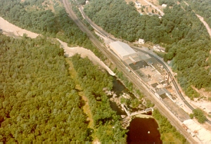
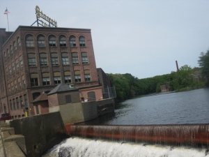
While the first communities in the region were mainly centered around agriculture, local rivers provided a convenient source of power that was increasingly utilized for manufacturing during the Industrial Revolution. By 1825 a plan was developed to extend the Erie Canal to Boston. The proposed route would include going down the Millers River as well as the Deerfield, Nashua and Charles Rivers. The project was scrapped because of the need to tunnel through the Berkshire Mountains. The Turners Falls canal is part of the original plan.
Although the canal system was never developed, the engineering and survey work that was involved played an important role in determining the route of the Vermont and Massachusetts Railroad. The Railroad began construction in 1847. When the Hoosac Tunnel was finished, the link between Boston and the West was completed and the towns along the Millers River and the railroad prospered.
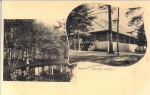
From the mid-1800s through the 1930s, recreation on and along some sections of the Millers River reached great heights, with several parks and camps developed by prominent groups and businesses. In the smooth water section between Athol and Orange, steamboats carried passengers and a number of recreational resorts and amusement parks were located along the river, with Brookside Park being the biggest. The many attractions at this 16-acre park near the town line included a dance hall, ball field with grandstand, cinder track for bicycle and foot races, merry-go-round, boxing and wrestling bouts, deer park, roller skating, cafe, trolley station—and of course, boating on the river. The park was destroyed by the high winds and waters of the 1938 hurricane.
The increased growth in the basin also brought the beginning of pollution problems. The first references to the problem appear in the Orange Journal in the 1890s. Several articles refer to the degradation of water quality and the construction of sewer outfalls by upstream communities. However, examinations by state health officials at that time showed the river to be clean. In 1922 the river was considered suitable for diversion to the proposed Quabbin Reservoir. In 1950, a report by the Massachusetts Department of Public Health evaluated the river as being “fairly good.”
By 1965, the river had degraded to the point where the Massachusetts Division of Fisheries and Game had to suspend stocking trout in the Millers River below the Otter River. The river was not clean enough to be stocked again until 1983.
Tool manufacturing and furniture making were dominant industries in the past, but most of these factories have since closed and the area supports light industrial and service oriented businesses. Athol was known as “Tool Town,” and Gardner as the “Chair City.” Templeton boasted paper mills while Winchendon sprouted many industries, such as furniture, woodworking and toy production, along the Millers River.
The communities of the region developed around the former industrial centers, which principally follow the Millers River watercourse. The river forms a natural pass through the Monadnock uplands to the west and the Connecticut River Valley. Agricultural or rural communities developed to serve these industrial centers. Today, agriculture is limited, and manufacturing jobs have decreased due to the closing or relocation of traditional industries.
In the wake of industrial decline, the service sector has been growing steadily in the past few decades. Many people leave the watershed to find employment, though the area’s natural beauty and rural charm continue to exercise their hold on people.
Sources:
- MRPC- FRCOG NPS Assessment Report (2002)
- Athol History Trail – brochure (1976)


Pingback: Overview: the Millers River – Blog Fly Fish