 The Millers River Watershed Council was formed at a time when the color and smell of the Millers River, considered by many anglers to be the “best trout stream in the state,” varied on a daily basis. In the early 1960s, farmers started fencing their stock away from once clear drinking spots along the river. In the late 1960s, at a meeting between a farmer and a University of Mass Dairy Extension agent at the

Confluence of Millers and Connecticut Rivers
confluence of the Millers and the Connecticut River, they decided to persuade two residents from each of the 17 watershed towns to meet and formulate an action plan to discover the cause and work towards a pollution solution. Uncertain of the sources of the problem, the group formed search parties to explore the watershed and, if and when sources were found, to lobby local and state officials to help them clean up the river. In this way, the Millers River Watershed Council had its beginning and by 1970 the group was incorporated as a nonprofit.
Passage of the federal Clean Water Act in 1972 helped the Council’s efforts to pressure municipalities and industries to construct and properly operate wastewater treatment plants. By the late 1980s and early 1990s, non-point source pollution had begun to receive increased attention, and the Council was successful in actively opposing “economic development” proposals involving the processing of toxic waste in Orange and the expansion of landfills in watershed communities.
The implementation of the Massachusetts Watershed Initiative in the late 1990s led to the creation of basin-wide Assessment Reports and Action Plans for the Millers River Watershed, as well as local Stream Teams for the Tully and Otter Rivers. While many water quality issues have been addressed by a variety of watershed stakeholders, many others continue to need attention, and the level of volunteer participation by community members continues to ebb and flow.

Millers River, Erving Ledges © John Burk
In 2005, a MRWC volunteer with a professional environmental background became its part-time Coordinator, and the organization focused more on a proactive approach to engaging local residents in watershed stewardship–including recreational, educational and volunteer water monitoring programs. In 2006, to provide water quality data the state was lacking, the Council began a state-approved multi-year sampling program for benthic macroinvertebrate (BMI), organisms, which are excellent water quality indicators.
Continuing its tradition of local advocacy, the Council participated in a successful campaign in 2009 to prevent a gas station from being built over a Zone II aquifer recharge area in Erving. That same year, the Council worked with the Town of Winchendon and the Massachusetts Watershed Coalition to develop a stormwater management bylaw that voters approved.
Stormwater management activities continued in 2011, when MRWC joined with the Montachusett Regional Planning Commission (MRPC) to implement a Clean Water Act Section 319-funded Stormwater Pollution Reduction Project, providing technical support and training to 10 municipalities in the Worcester County portion of the Millers Watershed. Three workshops and a Low Impact Development (LID) field trip were conducted in 2011 and 2012. In 2012 MRWC became a partner in MWC’s Billion Gallons a Year(BGY) Stormwater Reduction Campaign, and in 2013 MRWC worked with the Franklin Regional Council of Governments (FRCOG) to replicate the Stormwater Pollution Reduction Project for the seven towns in the Franklin County portion of the watershed (also with Section 319 funding).
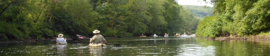
In 2010, the Council joined the newly-formed MassLIFT Initiative, gaining the half-time services of an Outreach Coordinator, and began to develop the Millers River Blue Trail Initiative for the Millers and Otter rivers. The original Miller River Blue Trail, connecting Athol and Orange, was launched in 2012–accompanied by a detailed map guide and the creation of a trail stewardship team to care for this first trail segment. The Blue Trail Guide for this stretch is available at a variety of locations. Accessible access improvements for this trail were made in 2018. In 2017, MRWC completed a series of inter-connected Blue Trail segments on the Millers and Otter Rivers. These “Upper Millers River Blue Trail” segments run from the Millers River in Winchendon and the Otter River in Gardner/Templeton to Birch Hill Dam in Royalston. These segments run through a wild like area abundant with wildlife, and paddlers should be prepared for beaver dams and downed trees.
In 2012, the Council also piloted a volunteer-based bacteria monitoring program that was completed the same year, as a compliment to the Blue Trails project. Subsequently, a volunteer monitoring program was successfully conducted for several years, yielding valuable information about river “hot spots” where bacteria levels tend to run high for up to 48 hours after a significant rainstorm. Additional water monitoring activities were implemented in 2013 through creation of the TribWatch program: volunteers regularly collected temperature, pH and other data at several locations throughout the watershed.
In 2016, years of extensive campaigning by countless activists across the state resulted in the suspension of plans by Kinder Morgan/Tennessee Gas Pipeline Co. to build the Northeast Energy Direct project: a high-pressure fracked gas pipeline that would have been constructed underground across nearly the entire state–from Richmond in the west near Pittsfield to Dracut, directly north of Lowell. The proposed path would have run through some of the states’ most sensitive lands, including private conservation properties and farmland, wetlands, wildlife reserves and state parks. The route was slated to cross beneath the Connecticut River, the Millers River (twice), the Tully River and numerous streams across multiple watersheds. MRWC played a leadership role in the grassroots coalitions that formed statewide to oppose the project, including North Quabbin Pipeline Action and the Massachusetts PipeLine Awareness Network (MassPLAN).
Since 2016, MRWC has worked closely with local residents and conservation groups to oppose expansion of the Gardner Sludge Landfill, and continues to advocate for an environmentally friendly and economically viable alternative–see the Sludge Landfill page on this site for detailed information. In August of 2021, MRWC announced the formation of a statewide Coalition For a Sustainable Alternative to Expanding the Gardner Sludge Landfill. The Coalition includes nine local, regional and statewide groups and organizations.
In February of 2023, in a major victory for MRWC and the Coalition–and our local communities!–the secretary of the state’s Executive Office for Environmental and Energy Affairs (EOEEA) ruled that the City of Gardner must prepare a Draft Environmental Impact Report (DEIR). The DEIR is expected to be submitted by the City in early 2024–stay tuned!!


